| GPS time series for Hengill |
|---|
|
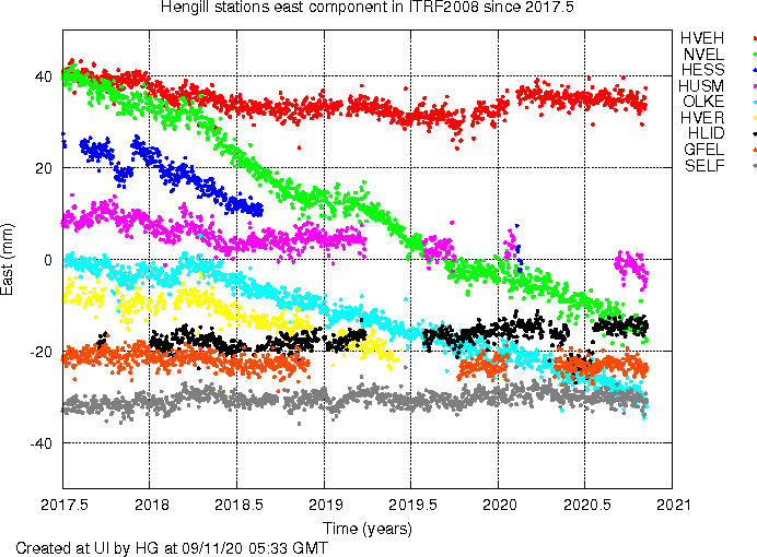
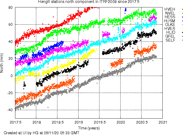
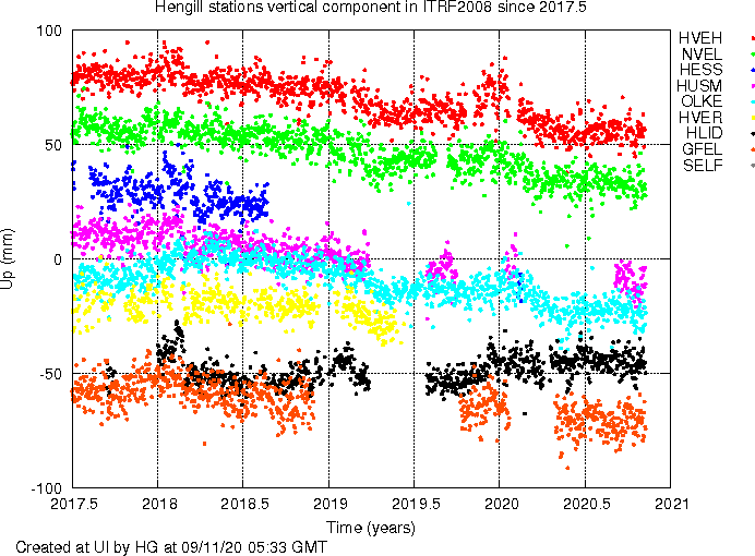
Combined plots for stations in the Hengill area, using results from GIPSY/OASIS PPP single site processing. Click on any image for a full-resolution pdf. Please respect copyright of the results. Last 100 days Last 400 days Final Time series: Final time series Residual (linear signal removed) time series Residual (linear and seasonal signals removed) time series Fit of seasonal signal Final time series including all outliers and offsets (uncorrected) Other plots: Combined plots |
|
|---|
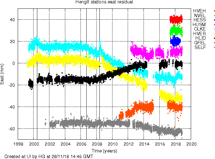
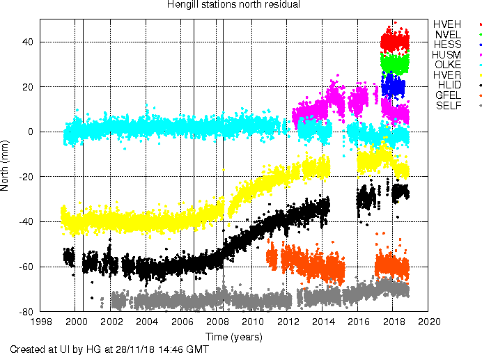
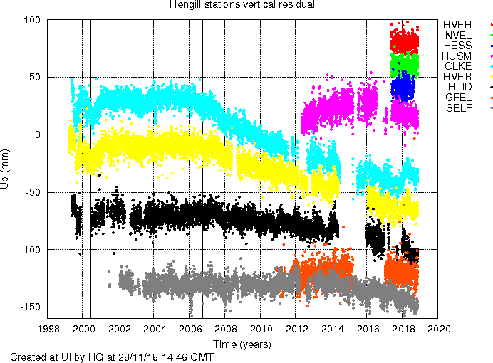
Last approximately three year of residual time series. Linear and seasonal (annual and bi-annual) signals have been estimated and removed, as well as some large offsets (2008 earthquakes). Data using preliminary satellite orbits are not included (i.e. data lag 5-15 days before present).
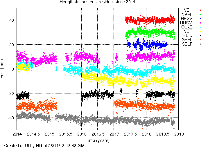
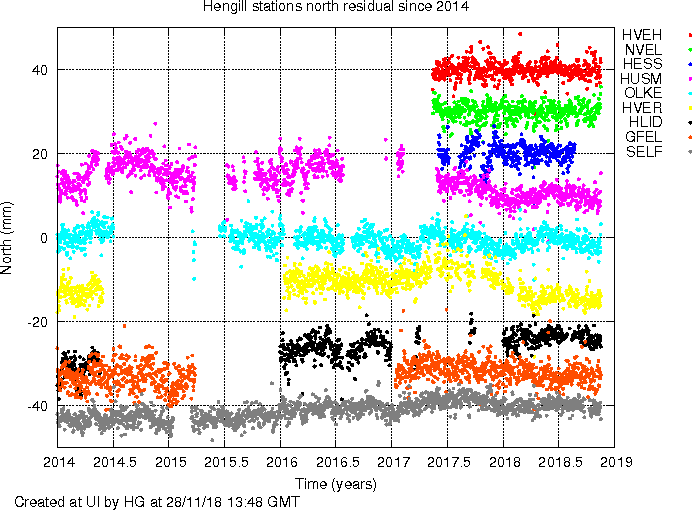
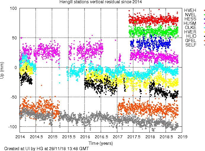
Full-length residual time series. Linear and seasonal (annual and bi-annual) signals have been estimated and removed, as well as some large offsets (2008 earthquakes). Data using preliminary satellite orbits are not included (i.e. data lag 5-15 days before present).